
Watching the waves here is fascinating, and easily becomes an addiction. I have met locals that come out here every time a winter storm brings the big waves in, and they tell me that they never get tired of it. I don’t think I’ll ever get tired of it, or get enough photos, but it’s a 33 hour drive for me. (so I don’t get to go as often as I would like.)
Timing:
When I first became interested in photographing the waves at Cape D (as the locals call it) I decided to just wait for a very windy day while I was wandering the state looking for other photos. I soon learned that finding the big waves here is more complicated, but also more precise than I had imagined.
The big waves here are not a year-round occurrence, but are typically the result of autumn and winter storms, November thru January. But having said that, I have shot decent waves in October and February, and there are photos from a “rare” April storm online: https://katv.com/news/offbeat/gallery/cape-disappointment-chaotic-waters-give-rise-to-coast-guard-training-ground#photo-1
There are two important factors to look for when forecasting the big waves (reaching 40′ or higher): the forecast swell height and the tide. (I have also read that the swell frequency is a factor, but don’t yet know what numbers to look for.) In my experience, the waves are very nice when the swells are forecast to be 12′ or higher. And much like photographing waterfalls, a wave does not have to be large to be beautiful. I have captured some very nice shots when the swells were in the 12-15′ range, and am looking forward to returning when the forecast calls for 17 – 20′ swells.
On 1-18-18 ( a week after I had to head for home) the swells were forecast to reach 25′, and the results were very dangerous for spectators, tossing large logs into the air, and destructive to the beach environment, destroying a number of the State Park camp sites.
https://www.youtube.com/watch?v=Tt0FNBW91e0
The second factor is the tide: regardless of swell height, the waves break higher in the two hours before high tide. Once the tide peaks, the large breaks are generally (though not always) much fewer and smaller. If high tides are at 7:50 am and 7:50 pm (as they are on 11-21-19, as an example), they will not be in your favor (because it will be dark when the waves are best).
The tool I use for the most reliable forecast of swell height is the “Windy:wind & waves forecast” app (Windy Weather Works, Inc) available for Apple and Android devices. (Not the same as Windy.com) This app presents a very easy to use depiction of the swell height and tide. They do not list Cape D as a location, but “Mouth of Columbia River” is the closest reporting site.
I have no information on how often you will find large swells and waves at Cape D. They were 15′ on 10-17-2019, and as of this writing (11-17-2019) have not been higher than 10′ since.
Weather:
Here is a view of some dramatic clouds to the east (shooting from the parking lot/viewing area, heading 75°)
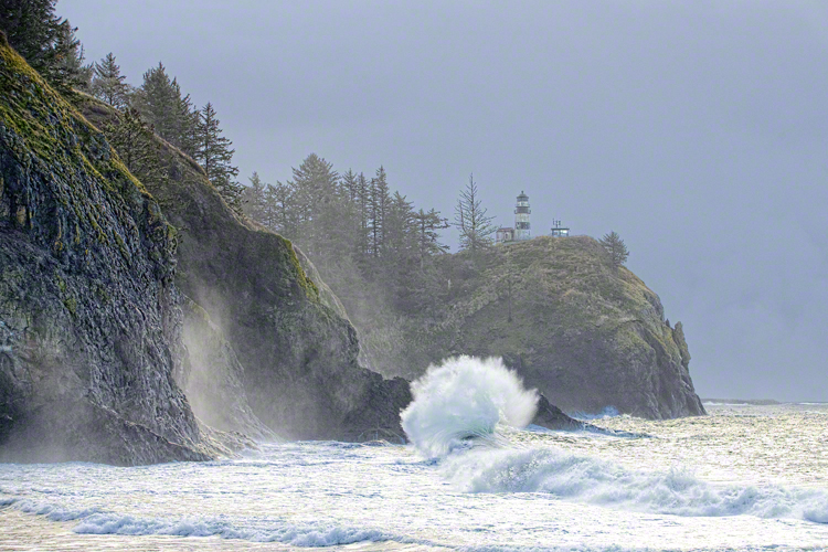
At nearly the same time, this is the view toward the lighthouse (heading 128°):
Weather and lighting change constantly and rapidly. Because the waves are the result of a winter storm, it is usually raining. On 2-20-19 it started out raining lightly, then there was sleet for a few minutes, then later the sun broke out and it got rather warm. A short time later it was cooler and raining again. Of the many thousands of images I have taken at Cape D, I have a few that include blue sky in the frame; most do not.
Environment:
Google Earth puts the base of the lighthouse at 200′ above sea level.
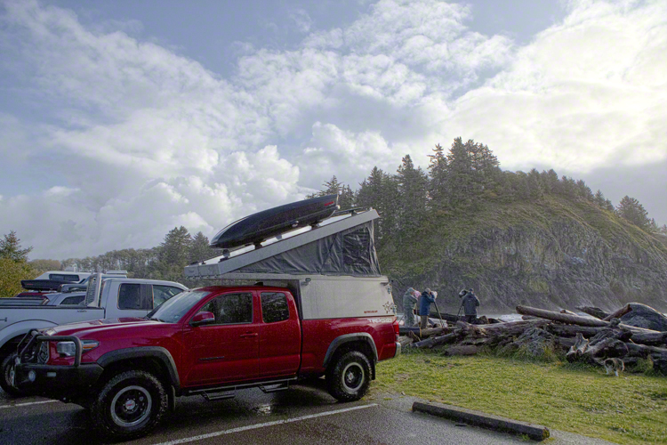
From the viewing area (edge of the parking lot, behind the red truck in the image above) to the base of the lighthouse is an approximate heading of 130° (southeast) and a distance of 2660′: which is almost exactly ½ mile. Here is a shot taken at 35mm:
N 46 16.8246 W 124 3.6145
(50 mm is called a “normal” focal length because the apparent distance in the resulting photo looks most like what you see with the naked eye. Hence the lighthouse in this photo looks somewhat smaller and further than it would if you were standing in the viewing area.)
Depth perception is difficult and inaccurate in this environment, but the following markers will assist in determining the distance to and height of the waves:
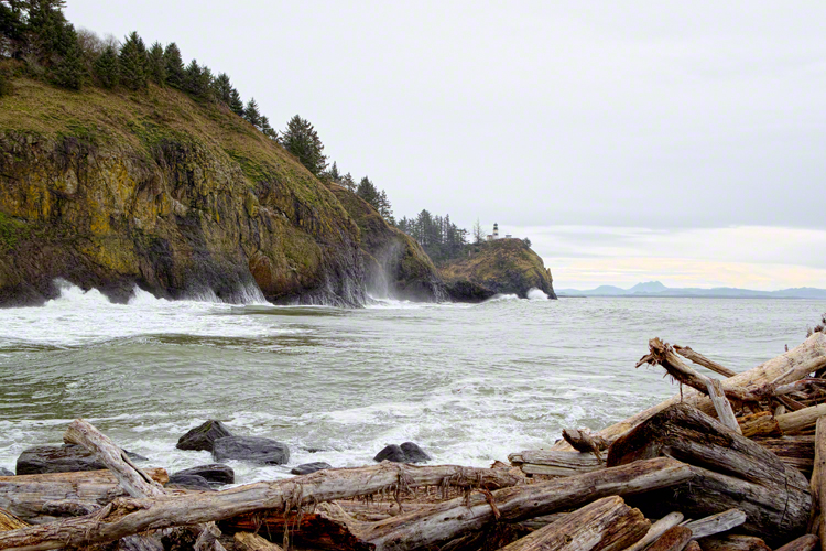
In this photo 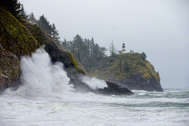
water is splashing over the low-point in the small peninsula in the center of this frame (directly below the lighthouse). Between the peninsula and the lighthouse is the entrance to “Dead Man’s Cove.” (I recommend using Google Earth to fully understand the layout of the area.)
From the viewing area to the point of the peninsula is approx 1325′ : which is half the distance from the lighthouse to the viewing area. Some waves appear to break on the tip of the peninsula: 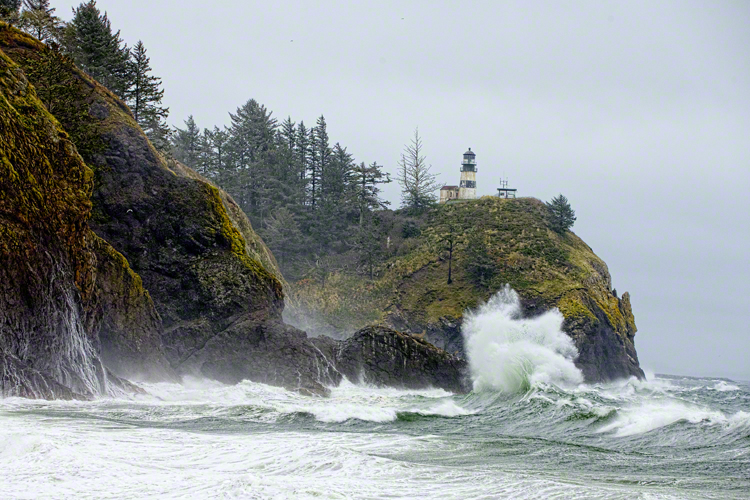
In certain conditions you will see some beautiful wave-breaks in the area just this side of the peninsula: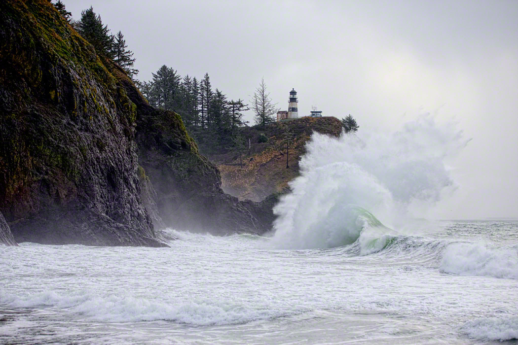
On 2-20-19 there was little or no action here, but 10-17-19, most of the waves were breaking in this area. The distance to this area is approx 1116′ from the viewing area. Rough calculations indicate that a wave that breaks in this area and appears to reach the base of the lighthouse is approx 76′ tall.
On 1-12-18 there were good breaks both in this area and against the cliff-face (described below).
The third and closest place where the waves break is the cliff face between the peninsula and Waikiki Beach (the beach directly in front of and somewhat left of the viewing area): 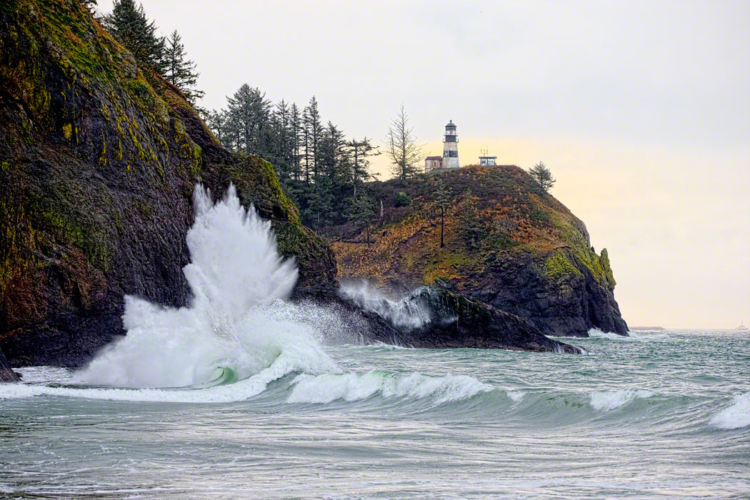
Equipment:
I use a 70 – 200mm lens, usually set between 90 and 130mm, with a full-frame sensor. Some people like to zoom in closer, but I prefer the 100 – 120mm range so that I can capture most of the waves without moving the camera.
I set up the camera on a tripod, with focus and exposure locked in, and use a wired remote so that I don’t have to look through the viewfinder. I can stand and talk to the other people there, and press the button whenever I see a photo. (socializing with the other enthusiasts is an important part of the experience) My camera is set to take 14 frames per second so that I can make sure I catch the wave at the perfect time, and also so that I can capture and keep an entire series. I have two such series on display now, where I printed 6 frames (out of a series of 36) that show the progression of the wave from just before contact, thru the explosion, then as it collapsed.
I shoot a lot of duds because I never know whether or not a swell will make a nice break: I pull the trigger whenever I see things start, but most of the time the images are not worth keeping. It’s a good thing digits are so cheap! On Feb 20, 2019 I shot over 28,000 images here and got nine wave series (one with 73 images, others were shorter) and over 50 singles that were keepers.
Finally, protection from the elements is very important, as the wind and rain can be quite heavy at times.
Other sites you may want to check out:
https://www.youtube.com/watch?v=olWpF2q1qks
Happy shooting!
No comments yet.